Writing is at standstill at the moment as I have an eye problem that prevents me from working on the computer (or it takes so long that I can’t do it anyway), so as doorways seems a popular feature of blogs, I thought I’d dig out a few of my favourites. The featured image is of a street of blue doors in East London, the others follow:
Lots of old doors in Honfleur, FranceCan’t resist including my favourite pub in BelfastNot exactly a doorway, but a delightful entrance to a restaurant in TokyoThe Strand, London
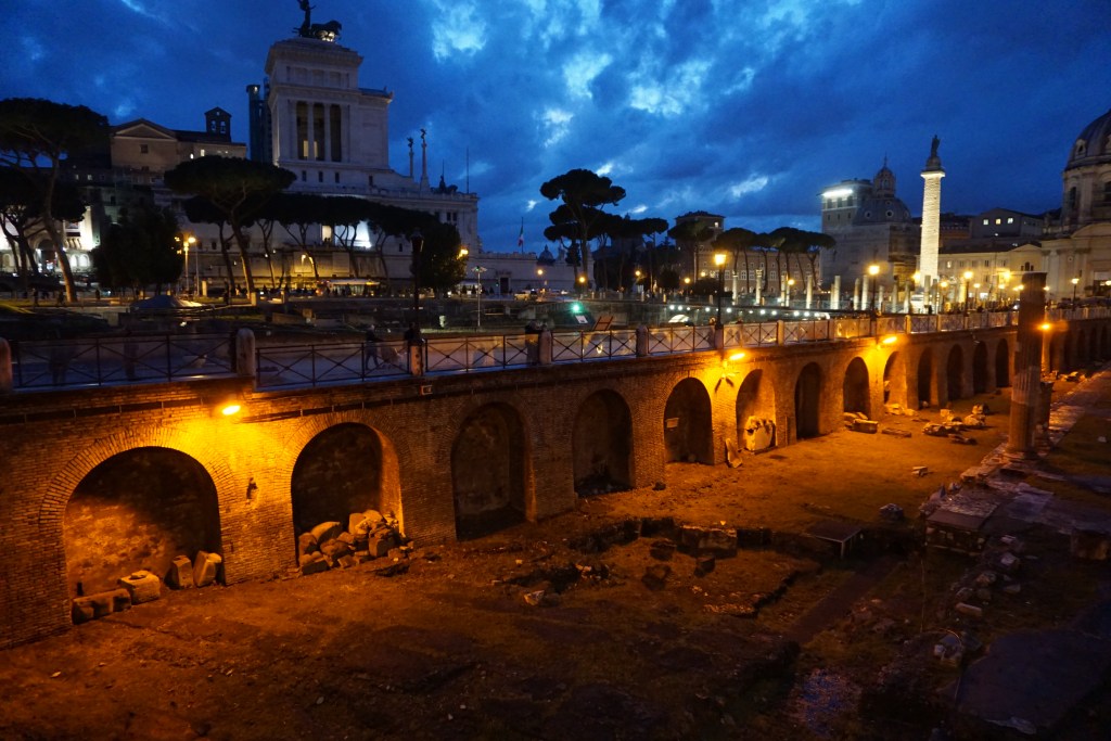
I didn’t imagine it would be so difficult to write about my walk on the Ypres Salient in Belgium, as I followed the course of the World War l battle of 1917 but it’s impossible to write about the horrors of the 3rd Battle of Ypres (also known as Passchendaele) without including great chunks of history to explain just why we were walking there, and a blog is no place for a history essay. That being the case, I have to forget my idea of doing a Monday walk for Jo and just add a few photos with connecting text. A few historical notes will be appended at the end of the blog for those who want to read them.
The Menin Gate just before the ceremony of The Last Post
First though, a few details.
During the course of the war, Ypres was all but obliterated by artillery fire. At the end of what we now call The Great War, it lay in ruins, only a handful of buildings left standing. First-time visitors to Ypres find it hard to believe that this magnificent town with its enormous square surrounded by medieval and Renaissance buildings was completely flattened by 1918. Virtually the whole of the town you see today was reconstructed from scratch, stone by stone, brick by brick during the 1920’s and 1930’s. Rubble that could be incorporated into the buildings was collected, cleaned and re-used and the planners, by referring to the medieval sketches and diagrams that had survived, were able to painstakingly rebuild the squares, streets and beautiful buildings of this ancient Flemish town.
Throughout the town, you will see bronze plaques bearing the outline of the Cloth Hall, the Cathedral and the Menin Gate at street corners. These are the signposts for the 5.5km provincial Heritage Footpath, the most complete footpath in the Ypres inner city.
Ypres had been fortified since about the 10th century and the Ypres ramparts are the best preserved in the country. The town originated on the banks of the Ieperlee and some ten centuries ago it was contained within little more than an earth wall and some moats, parts of which, dating from 1385, still survive. Later, stone walls and towers were added and later still, under occupation by the Habsburgs and then the French in the 17th and 18th centuries, the walls were strengthened, and bastions, advanced redoubts and more moats were added. The Lille Gate is the only city gate left out of the many that existed in the past.
The Ypres Ramparts are wide: strolling them in autumn is delightful as the falling leaves cushion the feet of the walker. The signposted route is 2.6 km long and meanders past lakes and ponds (the remains of the moat), interesting statuary, and through the Lille Gate into a small W.W.l military cemetery filled with the upright white headstones erected by the Commonwealth War Graves Commission, a sight all too familiar to visitors to France and Belgium. The municipal museum is located not far from the gate. Along the route, 23 panels provide information on the various points of Vauban’s ramparts.
There are 198 soldiers buried here, among them the graves of six New Zealand troops who were killed simultaneously by the same shell: their graves are now symbolically grouped together.
There follows some photographs I took on this walk which ended at the back of the Menin Gate, in some ways more beautiful than the gate whose picture we are familiar with at which buglers from the local Fire Brigade play the Last Post every night at 8 p.m. This custom has continued since 1928 when it was first inaugurated, save for 4 years during World War ll when the German occupation prevented it. This year being an Anniversary Year it attracts a few hundred people every night but sometimes there are just a few onlookers, yet the volunteer buglers nightly continue their tribute to the fallen.
The Menin Gate from the Ramparts side
This slideshow requires JavaScript.
Notes:
A. Engraved on The Menin Gate Memorial are the names of over 54,000 officers and men of the United Kingdom and Commonwealth Forces who died in the Ypres Salient before 16th August 1917 and who have no known grave. Tyne Cot has 35,000 names and there are 75,000 engraved on the Thiepval Memorial.
B.Menin Gate Last Post: At 7.30pm the police arrive and all traffic is stopped from driving through the Menin Gate until 8.30pm. For one hour the noise of traffic ceases. A stillness descends and the crowd is hushed.
7.55pm: Buglers of the local volunteer Fire Brigade arrive and stand ready at the eastern entrance of the Menin Gate Memorial. They then step into the roadway under the Memorial arch facing towards the town. The Last Post is played.
C. Of the battles, the largest and most costly in terms of human suffering was the Third Battle of Ypres (31 July to 6 November 1917, also known as the Battle of Passchendaele), in which the British, Canadian, ANZAC, and French forces recaptured the Passchendaele Ridge east of the city at a terrible cost of lives. It had been a battle across muddy, swampy fields taken and lost, then lost and taken again. After months of fighting only a few miles of ground had been won by the Allied forces at a cost of nearly half a million casualties on all sides.
D. The defence of Ypres was essential for the Allied forces as the town was a strategic point blocking the route of the Imperial German Army to the Belgian and French coastal ports (the ‘race to the sea’). Thousands of Allied troops died in the rubble of its buildings, the shattered farmland around it and in the fields and meadows that had been deliberately flooded by the Belgian King to try and prevent the enemy from gaining a foothold. Both sides fought ferocious battles and lived in inhuman conditions to maintain possession. The Allied losses were horrendous but thousands of German lives were also lost on the battlefields around Ypres during their four years of offensive and defensive battles.
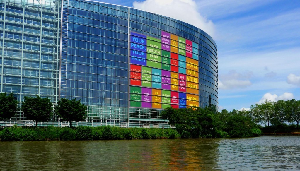
With the UK about to depart the EU albeit with an extremely narrow margin of Leave votes, my thoughts turned to my visit a few years ago to Strasbourg, site of the European Council and European Parliament and one of the loveliest places in Alsace.
This delightful city with its medieval churches and half-timbered houses seems to have become a byword for what some in the UK see as a hijacker of British sovereignty. Which is a shame, because that idea is blinding people to an elegant, international city of great charm that in the Middle Ages was referred to as The Crossroads of Europe. At that time, goods from the Baltic, Britain, the Mediterranean and the Far East poured across the borders to be traded for wines, grain and fabrics and just like today, when the languages of the 46 member states can be heard in the squares and streets of the city, traders speaking a dozen different languages, met and conducted business. The city continues to be the crossroads of Europe as people from different countries work and mingle in Strasbourg’s squares just as they did hundreds of years ago.
Once a free city within the Holy Roman Empire, Strasbourg later came under periods of French and German rule, which has given the ancient centre a unique appearance, half-timbered medieval houses sitting alongside elegant French-style mansions. In 1988, UNESCO classified Strasbourg as a World Monument, the first time such an honour was given to an entire city centre.
It is an easy place for visitors to discover as the traffic problems that beset most big cities have been solved here with a combination of canal boats, a sleek and comfortable light rail system, local buses, and pedestrianised squares. Although it presents itself as a folksy-like small town, Strasbourg is very international, cosmopolitan and multilingual.
GRAND ILE ISLAND
This is the historic part of the city where you will find the main sights and using the 142-metre high spire of the Cathedral as your landmark, you will soon find your way around Strasbourg.
The city’s charm has much to do with its canals which surround the Grand Ill island where Petite France, is located. A 70-minute boat trip (open-top in fine weather) on Batorama’s Twenty Centuries of History, circumnavigates the whole of the Grande-Île before skirting the 19th-century German Quarter. The turn-around point and good photo opportunity is where the European Parliament, Council of Europe and European Court of Human Rights are head-quartered, a magnificent display of concrete, steel and glass.
On the boat cruise you will see the Vauban Dam, near the confluence of canals by the Pont Couverts, a defensive lock which allowed the entire southern part of the city to be flooded in times of war. It is
They even grow grass between the tramlines in the street
Walking around the canals, especially in the early part of the year when everything seems green and lush and the spring flowers are out in abundance is an equally attractive way of seeing the main sights. This is a city that loves nature and it takes pride in decorating every bridge and windowsill with baskets of flowers, changed according to the seasons.
PETITE FRANCE, STRASBOURG (a UNESCO site)
The number one attraction in Strasbourg is Petite France, a photographic cluster of 16th and 17th-century half-timbered houses reflected in the waters of the canal. These houses were originally built for the millers, fishermen and tanners who used to live and work in this part of town. If you have taken the boat tour, you may like also to take a tour of the historic centre with an audio guide (€5.50) from the Tourist Office which will introduce you, via a winding route through the narrow streets, to a truly fascinating old town.
NOTRE DAME CATHEDRAL Opening hours: 7am-7pm
The Cathedral, an imposing red sandstone edifice, stands alone in its square and towers above the city. It was the tallest building in the world until the 19th century and is the second most visited cathedral in France after Notre Dame in Paris, receiving 4 million visitors a year. Built in 1439 it is considered to be an outstanding masterpiece of Romanesque and late Gothic art with outstanding 12th-century stained glass windows. Inside is one of the world’s largest astronomical clocks.
Try to arrive at the cathedral by noon to get a good viewpoint for the 12.30 display of the famous Astronomical Clock. The procession of sixteenth-century automata was designed to remind us of our mortality. Afterwards, you can climb 332 steps to the platform below the cathedral’s twin towers for a stunning view.
The narrow street that leads to the cathedral and the Place de Cathedral are the liveliest places in Strasbourg, especially in summer, and are filled with outdoor restaurants that remain open late into the night. Entertainment is in the form of jazz musicians, mime artists and clowns.
This is the oldest house in Strasbourg
And finally, Strasbourg’s Christmas Market has a high reputation but its popularity may be its undoing. After a few evenings of mulled wine, yuletide cake, Silent Night and Adeste Fidelis, a spring or autumn visit begins to look very attractive.
Strasbourg is a city that has a very special charm at any time of the year and the organisations that dominate its life are what still guarantees peace in Europe. If you are looking for culture, cuisine and character, Strasbourg is hard to beat.
A few recommended eating places: Expect the usual French coq au vin, boeuf bourguignon, crème Brulee and crepe Suzette, but be prepared also for the German influence of pork and sauerkraut.
First up though, is wine. Strasbourg is the capital of one of France’s premier wine regions and if you are in the mood to sample some of the best, head for Terres à Vin, 1 Rue du Miroir, tel +33 3 88 51 37 20, with several by-the-glass options from €3.20 to over €10).
Pain d’Epices, 14 Rue des Dentelles, for indulgent gingerbreads and cake and for the heady scents of spices.
Master-Patissier, Christian Mayer, offers a tea room second to none in Strasbourg at 10 Rue Mercière, just a few yards from the cathedral.
Maison Kammerzell 16 Place du Cathédrale, tel +33 3 88 32 42 14, where the oldest section dates back to 1427, is a Strasbourg institution. Occupying rooms on four floors, you can sample the house speciality of fish sauerkraut if you fancy that but there are many less thought-provoking dishes from which to choose, average €40 for three courses.
Au Pont Corbeau, 21 Quai Saint-Nicolas, tel +33 3 88 35 60 68, – a warm and welcoming place where the onion soup is so thick you could stand your spoon up in it. A modest but excellent wine list available. Average €32 for three courses.
The Batorama Tour departs from the Quai outside Palais Rohan, adults €12.50.
A ticket with unlimited tram and bus trips valid for 24 hours is available for €4.30. Also, you can rent bikes (vélhop) for $5 per day.
Castell Sant’Angelo across the Tiber – Photo Mari Nicholson
The Tiber has been the soul of Rome since the city’s inception, and it could be said that Rome owes its very existence to this strategically important river on whose banks the first settlements were built. The two sides of the river are joined by more than thirty bridges, creating a fascinating setting for the archeology and history of the eternal city.
Old View of the Tiber, possibly 18th century
Several of the old Roman bridges no longer exist, in Papal Rome and in the modern city seven were built in the 19th century and ten in the 20th century.
Ponte Sant’Angelo with statues
The Tiber (named after Tiberius who drowned in the river) is unlike rivers like The Danube, The Seine or The Thames as there is little activity on the water. In the summer, various boats convey tourists along the stretch of the river, but in general, it seems underused. However, along the Lungotevere, the boulevards that run alongside it, human traffic always seems to flow.
Flooding was a regular occurrence before the high embankments were built in the 19th century when there were houses located along the banks of this navigable river which was used for fishing and bathing. Over time, however, silting and sediment build-up meant that the river became unsuitable for navigation.
Looking down to Cavour Bridge, Rome
As in other cities such as Bangkok, Seville, London and Paris, tour boats were introduced along the river to give locals and tourists a unique opportunity to view the city. This is a great way to take in the panorama, and immerse yourself in one of the most evocative cities in the world.
A stroll along the Boulevard is also a favourite pastime and a visit to Castell Sant’Angelo and the Jewish Ghetto and Synagogue, which are both situated along the Tiber can be combined in a “Tiber walk”. There are many restaurants, cafes, and bars down by the river so sustenance is not a problem: these are very noticeable at night when the warm lights from their windows illuminate the Boulevards.
The Tiber, Rome – Mari Nicholson
Whether you opt for a dinner cruise, a daytime hop-on-hop-off cruise, or a private jaunt, along the way you can admire the great Palace of Justice, designed by William Calderoni; Sant’Angelo Castle, one of the oldest monuments of Rome; St. Peter’s Basilica, Tiberina Island, a picturesque island linked by one of the most famous bridges in the city, and the innumerable bridges that span the Tiber.
Ponte Sant’Angelo Looking towards the Castle – Mari Nicholson
When the surface of the Tiber is calm and the monuments that span the river are reflected in the still waters, they increase one’s delight in the vista they offer across Rome. Ponte Sant’Angelo (by the castle of the same name), Ponte Fabricio, Ponte Rotto, Ponte Garibaldi, they all offer a sense of the history of the city.
Angel on Pone Sant’Angelo – Mari NicholsonAngel on Ponte Sant’Angelo
The first named, Ponte Sant’Angela is the most spectacular, being embellished with angels carrying the instruments of Christ’s passion, and was designed by Gian Lorenzo Bernini whose fountain in Piazza Navona is one of the most photographed in Rome.
The Ponte Sant’Angelo was erected to ease the movement between the Vatican (which was also connected to the Castell Sant’Angelo) and the commercial area across the river.
The Vatican City is the only zone controlled by the papacy today, but in earlier centuries papal dominion was exercised over the entire city, hence the need for easy connection with the commercial area of the settlement. Three energetic popes, Urban VIII (1623–44), Innocent X (1644–55), and Alexander VII (1655–67), harnessed the versatile talents of the great artists nd sculptors of the day to build monuments and beautify areas all over Rome but especially in the Vatican area.
View from the Vatican to Ponte Sant’Angelo – Photo Solange Hando
A walk along the Tiber, and then up the imposing obelisk and olive-tree-lined road to the Vatican is an exercise in itself and you can be forgiven if you decide to postpone visiting St. Peter’s Basilica and the Vatican Museum until another day. It can take a long time to do justice to them both. A trip to the top of St. Peter’s is a worthwhile exercise but be warned, there are many steps to the top. A lift goes part way only.
Part of Bernini’s Magnificent 4-Rivers Fountain in Piazza Navona – Photo Mari Nicholson
How to get there: Ponte Sant’Angelo: Metro Line A, Lepanto stop. Boats leave from nearby. Buses 23, 34, 40, 49, 62, 280, 492, and 990. Tram 19.
Connections between rooms in castles are well documented, less well known is the connection between the Castel Sant’Angelo in Rome and the Vatican City.
The Castel of Sant’Angelo, the massive fortress-like building on the right-hand side of the Tiber, was originally built by the Emperor Hadrian (117-13 AD), as a monumental tomb for himself and his successors, not far from the Mausoleum of Augustus near the edge of the Vatican fields.
Castel Sant’Angelo, Rome. Hadrian’s Mausoleum
By the 5th Century, the Mausoleum had been included in the defensive system of the city walls, and from the 10th century onwards it had become a fortress, the Castel Sant’Angelo, its purpose being to defend the Vatican, to which it was linked by a special passageway (the Connect). Originally the Mausoleum was surmounted by a gilt bronze statue of the emperor in a chariot.
Below is a photograph taken from the cupola of St.Peter’s at the Vatican and the Castell is quite some way from it, on the left-hand side just beyond the patch of dark green trees that can be seen.
Looking down from St. Peter’s, Vatican City.
Looking Down from the Cupula of St. Peter’s in the Vatican, towards the Castel S Angelo. Photograph Copyright Solange Hando.
The Mausoleum was incomplete when Hadrian died but he was buried there one year later in 139 AD. The bridge connecting both sides of the Tiber had been built by Hadrian to facilitate direct access to the tomb, a more elaborate bridge than any other Roman bridge at that time: it survived until the end of the last century by which time it had become known as the Ponte Sant’Angelo. The two end spans were rebuilt at the end of the last century and only the three central arches are originals from the period 130-134.
Ponte Sant’Angelo, Rome: Photograph copyright Mari Nicholson
Postman’s Park in London contains a simple but evocative Memorial to unsung heroes of the 19th and early 20th century, in the form of a collection of glazed Doulton plaques on a wall protected from the elements by a loggia. Each of these plaques commemorates someone who, in tragic circumstances, died a hero, trying to save the lives of others.
What and where is Postman’s Park in the City of London?
First the name: the park acquired the Postman’s Park name because during it’s heyday in the 19th century and before it became the site of the Memorial, it was popular as a lunchtime retreat with workers from the General Post Office in nearby Clerkenwell, long since demolished.
Situated between King Edward Street, Little Britain and Angel Street and just round the corner from St Paul’s Cathedral whose steps are normally crowded with tourists hugging backpacks and guitars and where the streets are full of bankers and financiers bursting with self-importance, it contains a gallery of tiled memorials to extraordinary people who were, nonetheless, just ordinary citizens.
St. Paul’s Cathedral – Mari Nicholson
The brainchild of the Victorian painter and philanthropist, G.F. Watts (1817-1904), a radical socialist who felt deeply about the dreadful conditions of the London poor, and who had twice refused a Baronetcy, it is now regarded as a Memorial to Watts who made no attempt to hide his dislike of the greed of the upper classes of the time.
About the Tiled Memorials
Plaque to one of the child heroes on the Memorial of Heroic Self Sacrifice in Postman’s Park, London – Photo Mari Nicholson
A long, high wall covered with Royal Doulton ceramic plaques, decorated in burnt orange and blue, names, ages, occupations and means of death engraved on the tiles – this is a wall before which people have been known to stand with tears in their eyes. Tragedy after tragedy told in a few simple phrases, bring to life drownings, raging fires, train disasters, and runaway horse accidents, in which these workers and children had saved someone’s life by giving their own.
There is seating under the plaques and the garden area of the park is a restful place with bright flower beds and a gently trickling fountain, interesting shrubs and flowering plants. Of special interest are the large banana tree, musa basjoo, which flowers in late summer, and the dove tree, davidia involucrata. In fact, Postman’s Park is a perfect place for a lunchtime picnic.
In 1887, Watts wrote to The Times to suggest the creation of a park to commemorate ‘heroic men and women’ who had given their lives attempting to save others. This, he said, would be a worthy way to mark Queen Victoria’s Golden Jubilee year.
His letter to The Times did not stimulate any interest, however, but in 1898, St Botolph’s Church at Aldersgate purchased land that had previously been owned by the City Parochial Foundation, and they approached him regarding the Memorial. So, on the site of the former churchyard of St. Bolophs, there was erected a 50ft long open gallery along the wall of which he planned to place glazed Doulton tablets commemorating acts of bravery, each one detailing a heroic act.
One of Britain’s leading tile designers at that time, William de Morgan, agreed to work with Watts. Their collaboration, first unveiled in 1900, is what you see on the early plaques when you visit Postman’s Park.
About the Tiles and Plaques
Plaque to William Goodrum, a 60-year-old Hero, honoured on the Memorial wall in Postman’s Park – Photo Mari Nicholson
The plaques could easily be overlooked in the somewhat hidden corner of the park, but these beautiful hand-lettered tiles hand-painted at the Royal Doulton factory, when once you see them, live with you forever. Each one tells the story of a boy or girl, man or woman, who died trying to save another at the expense of his own. Told in a few poignant words, they nevertheless manage to paint a picture of a life unfulfilled that ended in tragedy. Take, for instance,
the young Alice “daughter of a bricklayer’s labourer who by intrepid conduct saved 3 children from a burning house in Union Street Borough at the cost of her own young life”. Or
William “drowned in the Lea trying to save a lad from a dangerous entanglement of weed”.
The stories seem almost Dickensian until the very real tragedies these plaques represent hit home and one realises that this was real life, not fiction. Life was harsh for those who didn’t own land or property of some sort in those days: violence and disease were everyday events. Prostitution and child abuse were rife in late-Victorian London, and these children who died, many of them orphans or ‘indentured workers’, each and every one of them would have been working at some poorly paid job.
Reading the tiles one is struck by the occupations that don’t exist any more and the causes of death that remind one of nothing so much as a Victorian engraving – a runaway carriage of four with a child trampled beneath the horses, a boy in the Thames (probably a mudlark) attempting to swim to land with his friend in his arms.
London’s Child Heroes, 10-year-old Harry Sisley, honoured here in a Doulton plaque on the Memorial in Postman’s Park, London – Photo Mari Nicholson
G.F. Watts and his Reasons for Erecting the Memorial
GF Watts wanted to use his art as a force for social change and his intention was to build a memorial that honoured ordinary people, people who would not have had a burial tomb at Highgate, Brompton or even St. Pancras & Islington Cemetery.
Watts had for many years collected newspaper reports of heroic actions and the plaques were based on these cuttings.
It was planned to have one hundred and twenty tiles in place for the opening, but sadly, it was only possible to erect four. By this time Watts was too ill to attend the unveiling and only nine more were added during his lifetime. His wife Mary, took over the work and added what she could before her death. Then, 78 years later, in 2009, the Diocese of London added a new tablet to commemorate one Leigh Pitt who rescued a nine-year-old boy from drowning in a canal. The plaque reads:
Leigh Pitt, Reprographic operator, aged 30, saved a drowning boy from the canal at Thamesmead, but sadly was unable to save himself. June 7, 2007.
Today you can see rows of blank spaces, although no doubt there were unsung heroes in the intervening years who were never commemorated.
This wall of tiled plaques to these forgottenLondoners is one of the city’s most moving Memorials and in 1972, along with other key elements in the park, it was Listed as a Grade ll site.
Postman’s Park in Recent Film
The BAFTA and Golden Globe-winning film Closer which stars Natalie Portman, Julia Roberts, Jude Law and Clive Owen (based on the play of the same name by Patrick Marber) references Postman’s Park in that the character Alice Ayres (Natalie Portman) fabricates her identity based on Ayers’ tablet on the Memorial which the film character had read.
It seems a shame that King Alfred, the man who defeated the Danes and united the English, has gone down in popular history merely as the man who burnt the cakes. But the city he made his capital does the man proud and it is impossible to stroll through the ancient streets of Winchester and not be aware of how “the Great” came to be added to Alfred’s name.
An unspoilt city and England’s ancient capital (the Court was mobile during the Anglo-Saxon period but the city was considered the capital of Wessex and England at the time), the cobblestones, buildings and monuments of Winchester, just an hour from London, ring with history. If you like big bangs and all things military, it is also home to a host of museums dedicated to all things warlike. Surrounded by water meadows and rolling downland, it offers the best of city life – modern shopping, quirky open air events, and great entertainment and it can be covered in a day (although a couple of days will show more of what is on offer and allow trips into the surrounding villages).
Fulling Mill Cottage and River Arle
To get a panoramic view of the streets and buildings laid out according to the original Saxon plan, a good starting point is St. Giles’ Hill (a great spot for a picnic), from where you can pick out Hamo Thorneycroft’s famous statue of King Alfred. Then follow in the King’s footsteps from the walls erected to keep out the Danes to what is the largest medieval cathedral in the world. Famous for its treasures, from the sumptuously illustrated 12th century Bible to medieval paintings and a 16-metre stained-glass window 66% of which dates from medieval times, Winchester Cathedral is that much-overused word, awesome.
One of the Gormley statues in the Crypt of Winchester CathedralThe Crypt, Winchester Cathedral
The newest acquisition is Sound ll, the Antony Gormley sculpture now permanently installed in the cathedral’s crypt where it looks particularly striking when the crypt floods which it frequently does. Even if you don’t make a habit of visiting cathedrals, do make an exception to view this magnificent Gormley work.
The Cloisters, Winchester Cathedral
Fans of The Da Vinci Code will be interested to know that the cathedral’s North transept doubles as the Vatican in the film of the book, but those of a more classical bent will head for the tomb of Jane Austen which can be found in the nave where there is also a stained glass window to her memory.
Jane Austen Plaque in Winchester Cathedral
The novelist died in Winchester on 18 July 1817 and is buried in the cathedral. While in this part of the cathedral, take note of the black font which depicts St. Nicholas of Smyrna giving an old man three bags of gold for his three daughters, said to be the forerunner of the pawnbrokers sign of three golden balls.
Continuing in the footsteps of King Alfred you could then head up the High Street to the Great Hall, all that remains of Winchester castle, and which for 700 years has housed the legendary Round Table. Old it certainly is, and round, but it hangs on a wall where with its red, black and white colouring it resembles an enormous dartboard. According to myth, the original was created by the wizard Merlin, but carbon dating in 1976 proved that this particular table was not made in the Arthurian 6th century but in the 13th, and this use of HyperPhysics sadly put paid to the legend.
The Round Table, High up on the Wall
Just outside the south door of the Great Hall, is Eleanor’s Garden, a re-creation of a medieval herbarium with turf seats and a camomile lawn, named after Eleanor, wife of Henry III, and Eleanor, wife of Edward I. All the plants you see would have been grown in the 13th century, when floral symbols had priority over design. The rose, lily, iris and strawberry plants represent aspects of religion while the greens – the grass, ivy, bay and holly represent faithfulness.
The oldest continuously running school in the country, 14th century Winchester College which became a model for Eton and for King’s College, Cambridge is nearby. You can join a guided tour for an intriguing glimpse into the medieval heart of the college, the 14th century Gothic chapel with its early example of a wooden vaulted roof, the cloisters (where graffiti carved into the stones during the 16th and 17th centuries is still visible) and the original scholars’ dining-room. As a complete contrast, you could later check out medieval Westgate, a fortified gateway which served as a debtors’ prison for 150 years and where prisoners graffiti is also still intact, albeit rather different from that of the scholars!
Westgate
One expects to find ghosts in most ancient cities and Winchester is no exception. The most famous haunted Inn is The Eclipse in The Square, where the spectre of Alicia Lisle haunts the corridors. Seventy-one years old when she was found guilty of harbouring rebel cavaliers and sentenced to death by Hanging Judge Jeffreys, she spent her last night here in 1685 listening to the scaffold being erected for her hanging.
Old Prison Gate
At the Theatre Royal in Jewry Street, a wandering apparition haunts the dress-circle and gallery looking for her long lost lover while in the 18th century High Street offices formerly occupied by the county newspaper, the rattling chains of a woman dressed in grey has been known to rattle the staff on more than one occasion.
Streams and waterways punctuate the streets of the city giving it a homely atmosphere – especially when you see someone hauling a fine trout out of the river – and the Bikeabout Scheme means that you can tour around for most of the day for the small registration fee of £10. Reflective jackets and helmets are also available.
Half-timbered hous in Winchester
You don’t need to cycle of course: there is a good transport system from Winchester to the picturesque villages of the Itchen and Meon Valleys, handsome Georgian colour-washed Alresford (pronounced Allsford) for instance, home of the famous Watercress Steam Railway where you can make a childhood dream come true by riding on the footplate. Later, stroll down the town’s elegant streets with their antique shops, and discreet fashion boutiques or along the riverside where the thatched timber-framed Fulling Mill straddles the River Arle. Alresford is the home of watercress farming in the UK, so expect to sample gourmet dishes made of the green stuff – watercress pudding, watercress quiche and even watercress scones with afternoon tea – in smart bistros, tea rooms and old-fashioned pubs like the Wykeham Arms with its award-winning menu.
If there are children in the party, then don’t miss Marwell Zoo. Home to over 200 species of animals and birds, from meerkats to sand cats, and some of the world’s rarest big cats including the Amur leopard and the snow leopard. There are volunteer guides around the park to help visitors and to explain and illustrate the efforts the zoo is making to rehabilitate endangered animals back in their habitat.
And after all that history and ancient stones, Winchester can still surprise you with its pedestrian-friendly streets, colourful markets and exquisite boutiques nestling beside large-scale stores. The High Street – once the Roman’s east-west route through the city – is home to stylish shops with Regency and Elizabethan bow-fronted windows, while The Square offers quaint pubs and restaurants after your exertions, and everywhere you’ll find bronze and stone carvings, many by famous sculptors. It lies just one hour by train from London, 40 minutes from Portsmouth Ferry Terminal, and 15 minutes from Southampton Airport.
Very Old Barn, NB date of erection in grey bricks at bottom of building.
Winchester’s a winner, and whether you taste runs to real ale or English wines, pub grub or gourmet dining, Goth outfits to designer chic, you’ll find it all here amidst the quiet stones that hold history’s secrets.
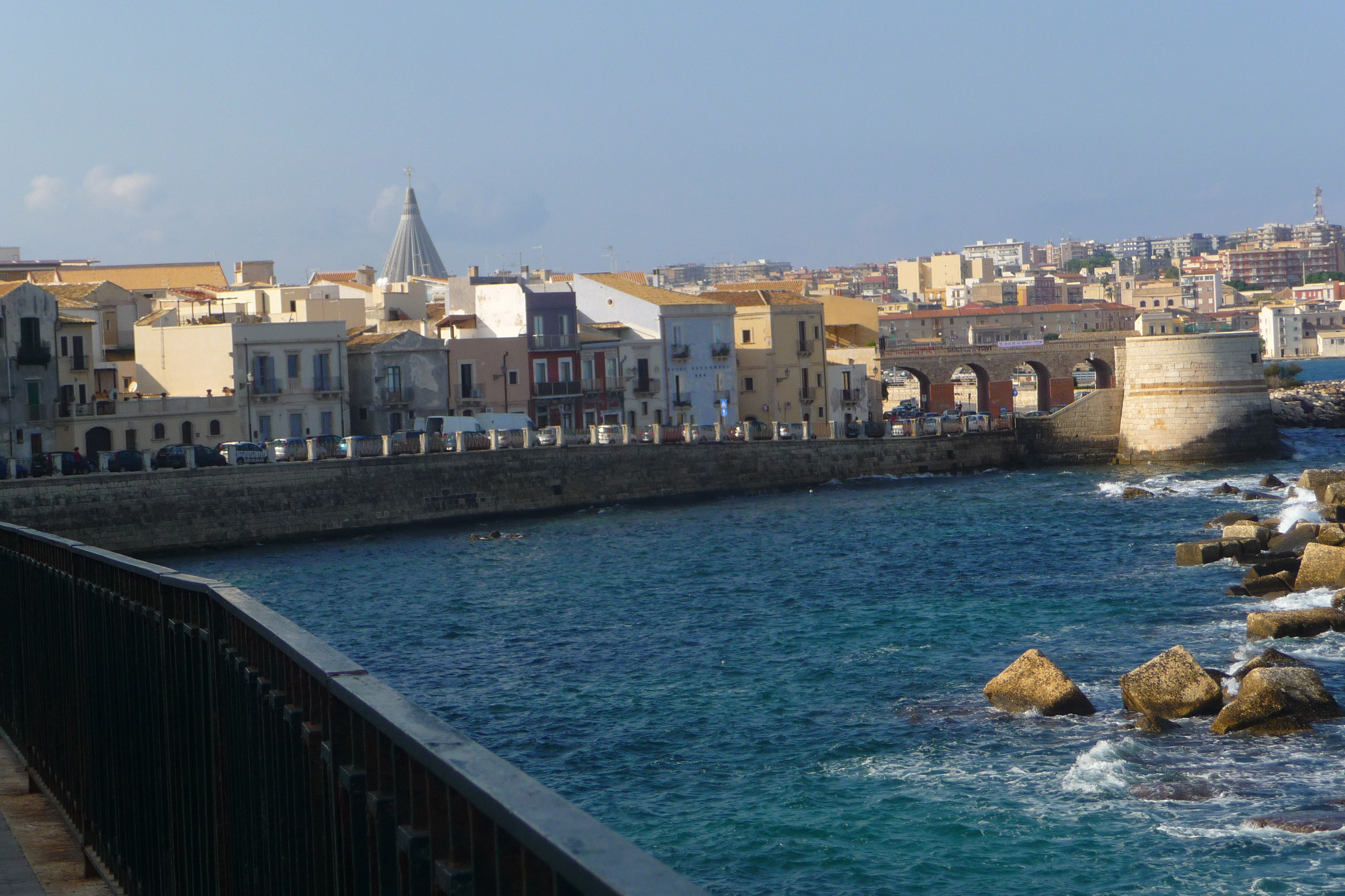
Syracuse (often spelt Siracuse) in south-east Sicily, is often overlooked in favour of the more touristy Taormina but the visitor to Sicily should not miss this city that was described by Cicero as the greatest Greek city in the world.
Assaulted by Romans, Byzantines, Vandals, Arabs, Normans and Spanish, Sicily has absorbed these foreign cultures and made it her own, perhaps best exemplified by the Cathedral in the Piazza Duomo, the delightful pedestrianised square in the heart of Ortygia, the island in the centre of Syracuse.
The façade of the cathedral is 18th-century and like so much of Sicily’s architecture, it was erected following the earthquake of 1693. It is actually built on successive altars to the Temple of Athena, the doors of which were said to be made of gold and ivory. Round about the 17th century the temple was transformed into a Christian church which later became the Cathedral. Walk down Via Minerva to view the outside of the Duomo and see how nothing was wasted: the giant Doric columns of the Greek temple to Athena were incorporated into the church that superseded it.
Ancient Greek Pillar still supporting the Duomo
Syracuse Town
Courtyard in Piazza Duomo, Siracusa
The Piazza is regarded as one of the most beautiful in all Italy with the Cathedral on one side and various Baroque palaces dotted around the square. Day and night the piazza is a scene of energy and life as the ground floors of the once-great palaces now mostly operate as restaurants, cafés and bars. On a warm evening there is no better place in Syracuse in which to sit and enjoy an espresso or aperitif.
A Bridge Links Old and New Syracuse
There are two main areas in the town, the archaeological area which includes Greek and Roman theatres and remains, and Ortygia, a small island that feels more like a tiny peninsula, with beautifully restored Baroque buildings, a number of fine hotels and some great restaurants.
The Archeological Area
Temple to Apollo in Piazza Archimedes, Syracuse
In the Neapolis Archaeological Park situated in the northwest of the town, are a number of well-preserved Greek and Roman remains.
Greek Theatre, Syracuse
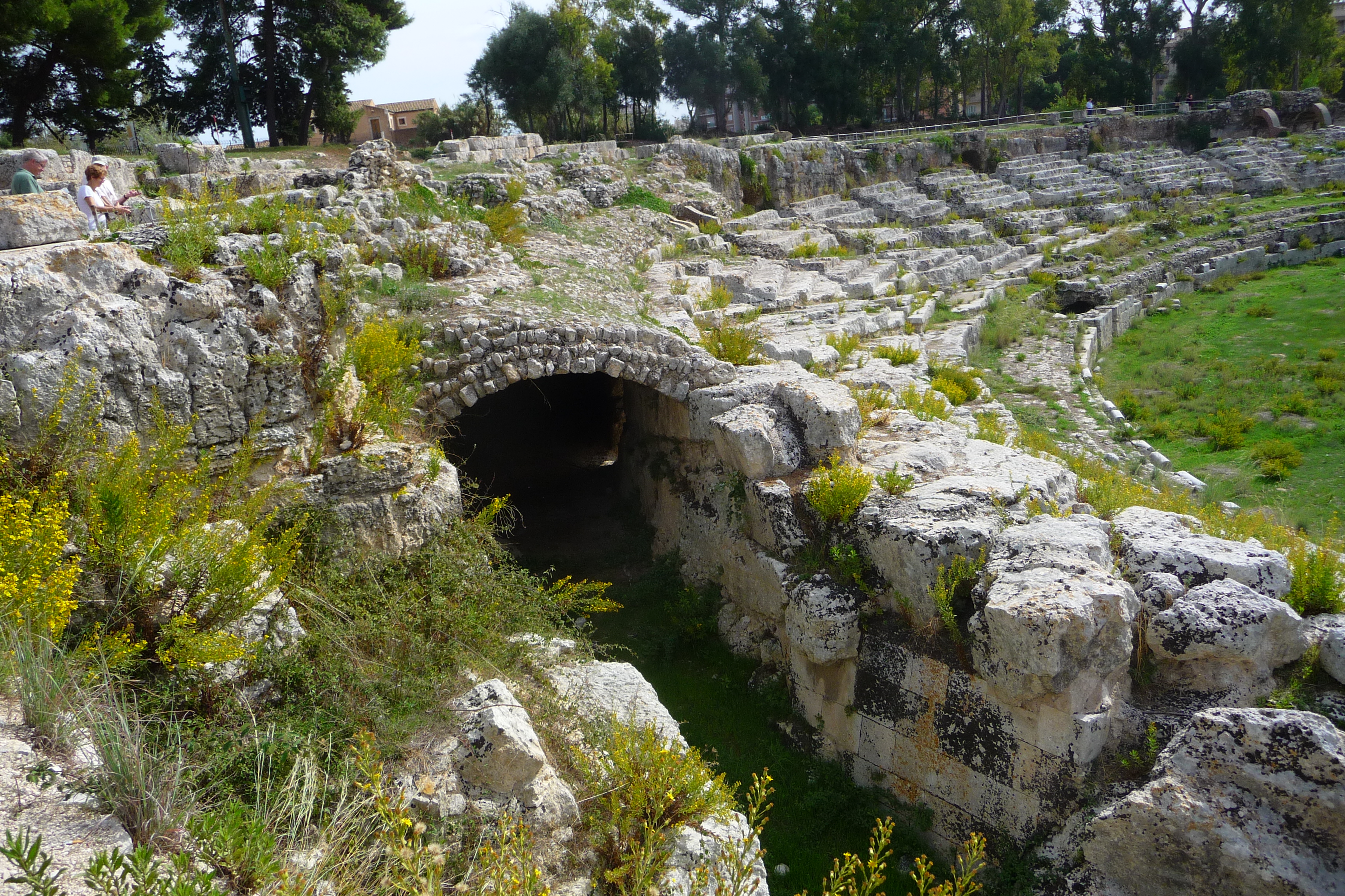
The main attraction is the Greek theatre (not to be confused with the more often photographed Greek Theatre in Taormina which has as its backdrop the snow-capped Mount Etna) where the plays of Aeschylus and Euripides are still performed from May to the end of June each summer as they were more than 2,000 years ago.
Started in the 5th century when Syracuse was one of the great cultural centres of the Mediterranean world, the theatre is considered to be one of the most perfect examples of Greek architecture to have survived and can accommodate up to 15,000 spectators in its 59 rows.
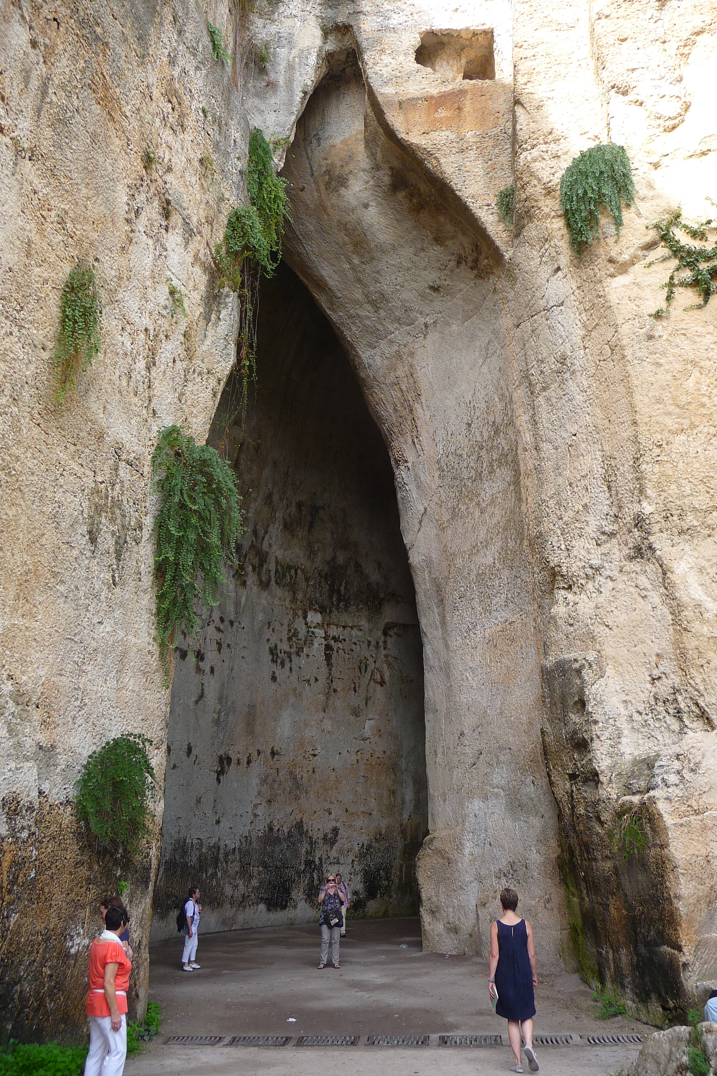
The Ear of Dionysis
The nearby fragrant lemon grove was once an old stone quarry used at one time to house 7,000 Athenian prisoners of war, the limestone dug from it in 500 BC being then used to build Syracuse.
Wander into the vast man-made chamber known as Dionysius’s Ear, a 20m high pointed arch cut into the rock face which owes its name to a visit by Caravaggio in 1608. Used as a prison, the excellent Cathedral-like acoustics meant that the prisoners’ conversations could be heard from outside.
There is also an impressive Roman amphitheatre, approximately 140m long, built in the 3rd Century AD where traditional blood sports took place, gladiators and wild animals providing the blood-letting that was so much part of these offerings. The hole in the centre is believed to have been a drain for the blood and gore – as one guide told me – or, a space for scenic machinery – as another guide told me!
Roman Amphitheatre, Syracuse, Sicily
The Archaeological Museum is just a short walk from the park and if time allows, it is worth a visit.
Ortygia, 2,55 Years of History
At only 1km by 500m, the best way to see Ortygia is just to wander through the area admiring the Norman buildings and the Baroque decorative facades. Enjoy the sun at one of the cafes in the area sipping a café or an aperitif, or lunch al fresco at one of the many good restaurants on this tiny island. Take a picnic and sit on the seawalls and admire the fish that swim lazily in the clear waters of the bay.
Clear Waters of the Bay in Syracuse, Sicily
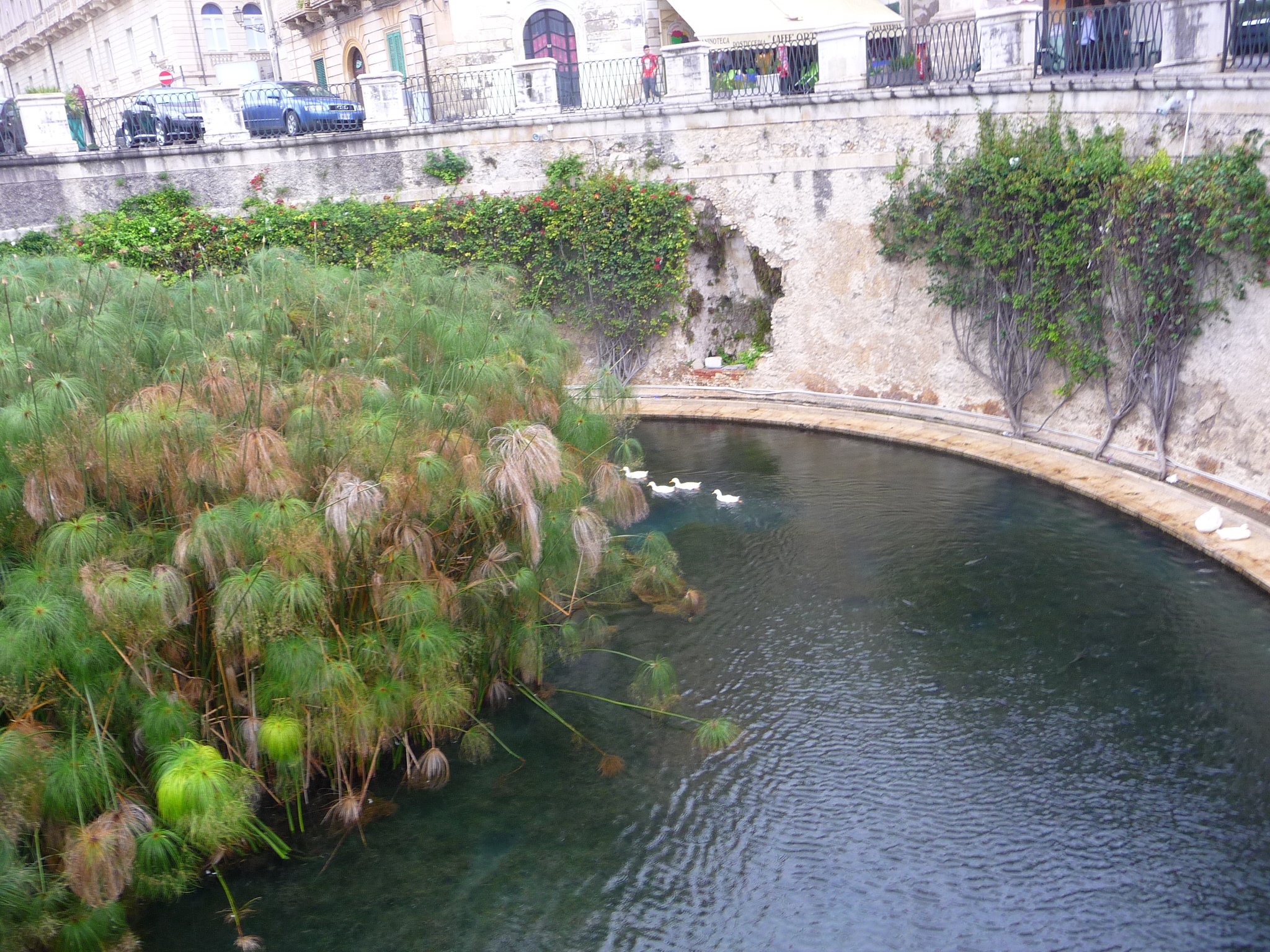
One could easily walk past the Fountain of Arethusa. filled with white ducks and surrounded by walls of greenery, as it looks so unpretentious but it is one of the most important sights in Syracuse.
Legend has it that the Arcadian nymph Arethusa, fled underwater to Syracuse to rid herself of the amorous advances of the God Alpheios and the Goddess Artemis transformed her into the freshwater spring that we see today.
The ruins of this Doric temple stand incongruously in the middle of the town (you can’t miss it as it’s on a main thoroughfare), on one side of which is a bustling market with sellers hawking clothes, handbags, umbrellas and anything else that will sell.
Temple to Apollo, Siracusa, Sicily
It seems such a pity that the Temple is not isolated so that visitors could enjoy it in tranquillity, but then it was probably full of bustling life when it was in use back in the 8th century BC when it was at its most active. It is the oldest temple in Sicily and over the centuries it has been a Byzantine church, a mosque and a Christian church.
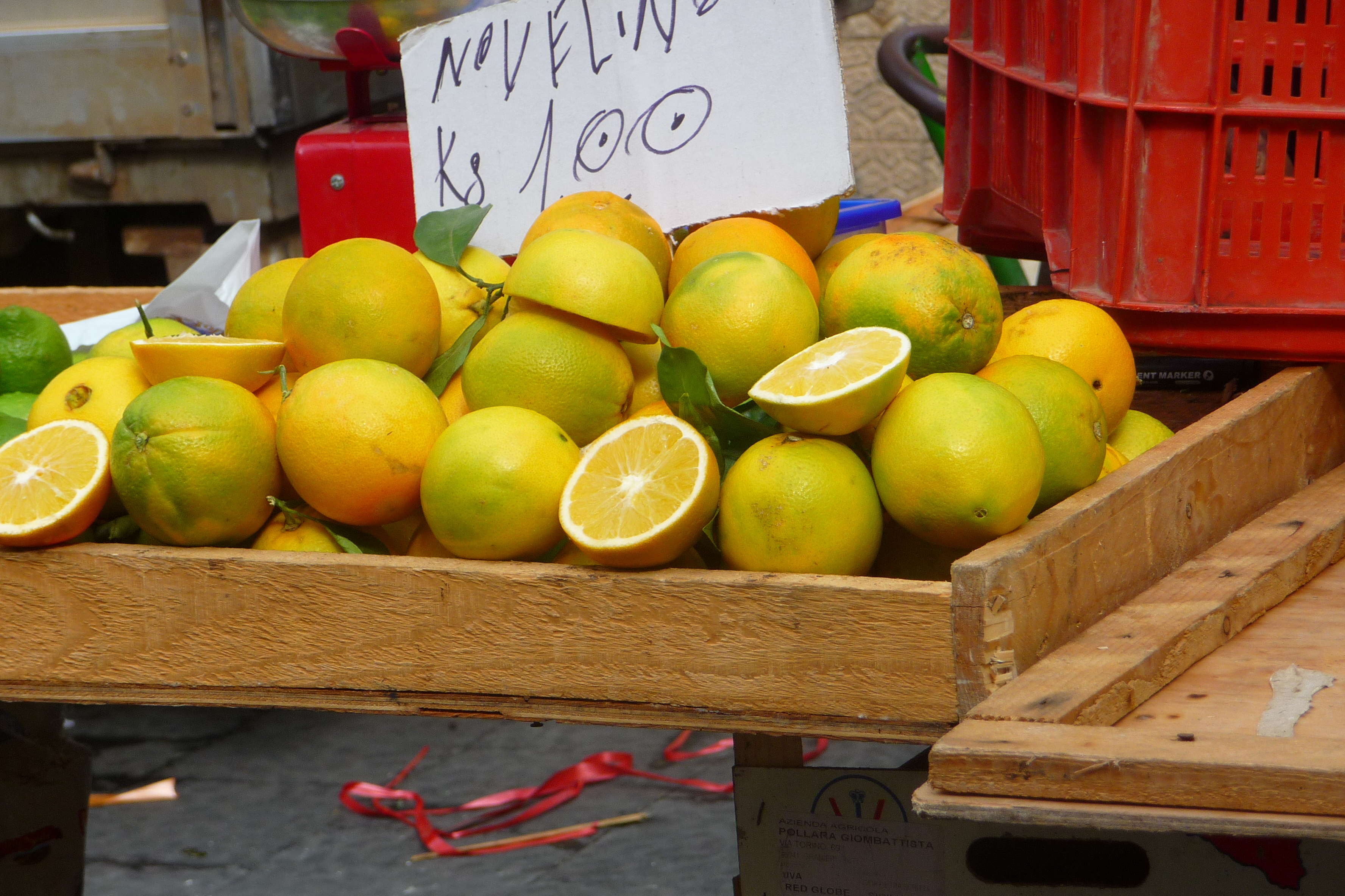
Citrus from Sicily
Plato visited Sicily several times as did Simonides and Pindar, and Aeschylus sang of its beauty. Its enormous military power made it capable of withstanding attacks from Carthage and Athens and it remained powerful until the Arab conquest in 878 when it lost its supremacy.
Sicily, with its dark history, rough mountains, ravishing scenery, and Etna, that brooding snow-capped volcano that is never far from people’s thoughts, is one of the Mediterranean islands to which I am constantly drawn back. I go there for the known attractions and for the food, heavily influenced by the cuisine of the many nations that conquered the island, and for the Baroque towns that sprang up after the earthquake of 1693 that devastated the south-east of the island. All are beautiful, but the finest of them all is Noto, a town built of golden stone from a local quarry and a UNESCO World Heritage Site. After the earthquake, Giuseppe Lanza, Duke of Camastra, employed the best architects of the day to rebuild the city just south of the original town: the result is a triumph of urban planning and harmony. Noto is in the province of Siracusa, itself a gem of a city and one that should not be rushed through as it has some of the most beautiful buildings in the area, plus the world famous Duomo in the Piazza of the same name, a sea-front with a wall just made for sitting on while you feast on a gelato. Noto lies about 35 kilometers southwest of Siracusa and is easily reached by local trains which run regularly.
It was built almost entirely in the prevailing style at the time, Baroque, and these near-perfect buildings are what makes Noto so special and which earned it the title of UNESCO World Heritage site.
It is a very accessible town. You can wander the length of the graceful Corso, stopping here and there for a coffee and one of Noto’s famous cakes, or a gelato or freshly squeezed orange or lemon juice. Take a detour down the side streets and climb the steep steps to the top where the aristocrats lived, then come down to the next level which housed the clergy and other nobility, before arriving back at street level where the ordinary people lived. One of the best streets in which to wander is the Via Nicolaci, famous for its buttressed balconies held up with playful horses, griffons, cherubs and old men, incongruous on an otherwise severely classical façade.
Just at the top of Via Nicolaci is the beautiful elliptical façade of the Chiesa di Montevirgine. I didn’t have time to count them, let alone visit them, but I was assured that Noto has thirty-two churches. Think on that – thirty two churches.
So, what to visit when you are only there for a day visit. If time is short my advice is just to wander. Like Florence, the history of the town is in its buildings, their façades and the sense of life in the streets. The Cathedral rises impressively above Corso Vittorio Emmanuelle and is approached by a wide and graceful flight of steps and its simple interior
may well come as a surprise in contrast to its exterior.
I had initially mistaken the flamboyant Chiesa di san Dominica for the Cathedral, flanked as it is by huge palm trees and looking more Middle East than Mediterranean. The Municipio (town hall) has an exuberant trompe l’oeil ceiling and a “magic mirror” which is just a mirror of illusion. My own favourite interior was the Vittorio Emmanuelle Theatre, still offering productions to its patrons, a fantasy theatre with red velvet and gilded boxes lining the walls echoed by heavy drapes curving round the proscenium arch.
If you want to imagine what Italian towns looked like in the 17th century, then Noto should be on your list of towns to visit – it’s very special.


")

